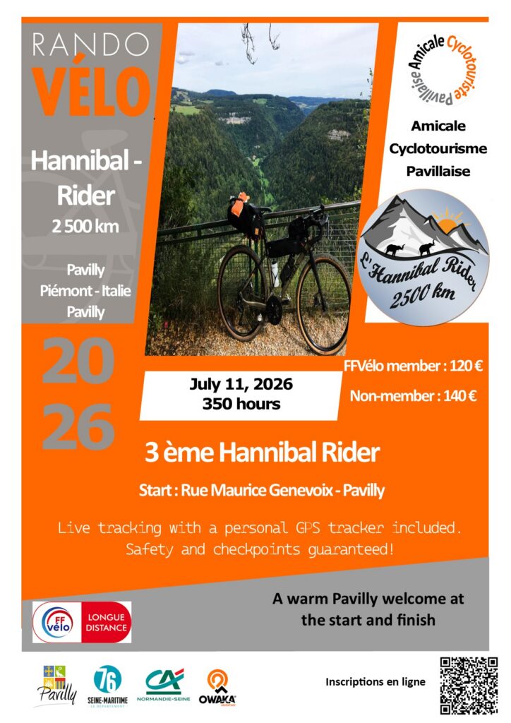
The Amicale Cyclo Pavillaise, based in Pavilly (Seine-Maritime), is pleased to organize the 3rd edition of the Hannibal Rider, a long-distance cycling tour totaling 2,500 km.

This brevet complies with the regulations of LRM (Les Randonneurs Mondiaux). Taking into account the significant elevation gain, it must be completed within 350 hours (167 km/day) maximum.
Start Date: July 11, 2026
NEW: Each participant will now be equipped with an Owaka Live Tracking beacon. It will automatically validate the checkpoints and provide real-time tracking that everyone can share as they wish. For the organizers, it was essential to provide you with this tool to enhance your safety.
Limited to 100 participants, the registration fee is €120 for FFCT members and €140 for non-members.
For further information, contact PATRICK: lpchretien@free.fr
Starting in Normandy, the route crosses the Jura and Alps mountain ranges to reach the Piedmont region in Italy. You’ll ride mostly on small, quiet, and scenic roads.
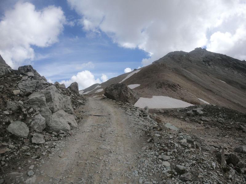
With major elevation gain and high-mountain gravel sections, suitable gear is essential: tyres with a minimum width of 32 mm are strongly recommended.
Key figures:
- Total elevation gain: 39,200 m
- Gravel sections: 125 km
- 50 mountain passes, including 15 over 2000 m
- 22 BPF sites for collectors
The Hannibal Rider is not a race but a personal challenge.
You can view the route on Openrunner by searching the keyword: LRM ACP.
Hannibal Rider 2024
Profile
Description
Description partiel du parcours :
The route begins in Normandy, more precisely in the Regional Natural Park of the Seine River Meanders. After a few steep climbs to warm up, you’ll reach the charming Eure Valley. Then comes the upper Chevreuse Valley with its beautiful Rambouillet Forest, followed by the scenic Essonne Valley with its hidden gems.
From Vézelay to Autun, the Morvan region offers stunning views, but beware—your legs will feel it! The Mâconnais and lower Jura regions also have their share of rolling hills. Things get serious in the Ain region, with the iconic and steep Grand Colombier climb! But first, you’ll have to cross the impressive Cize-Bolozon viaduct through the Gorges de l’Ain.
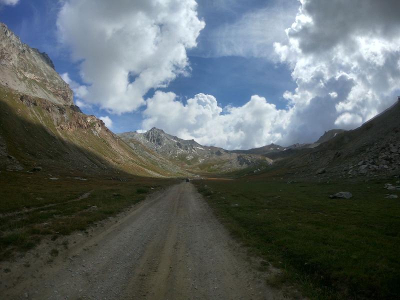
High mountain territory truly begins at the “Little Venice of the Alps,” Annecy. It’s a great place for a lakeside break before tackling the toughest 800 km of the route. The mountain passes come one after another, each higher than the last, culminating at 2,764 meters on the French side. From the Fort de Variselle, enjoy breathtaking views over Lake Mont-Cenis before descending into Italy.
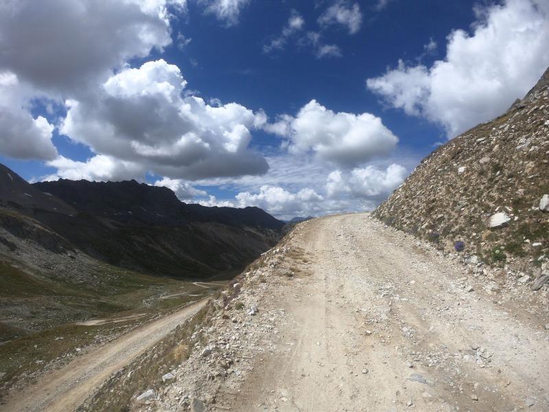
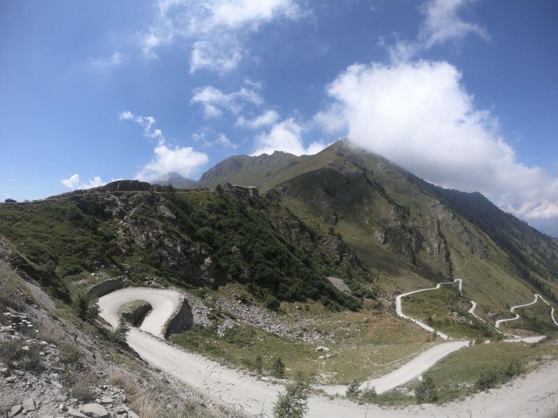
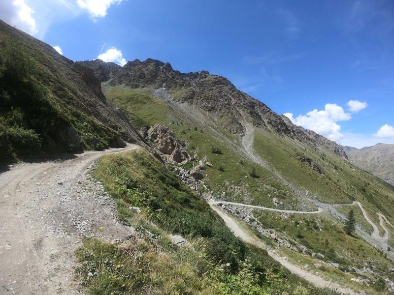
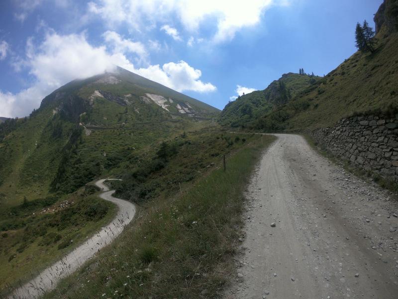
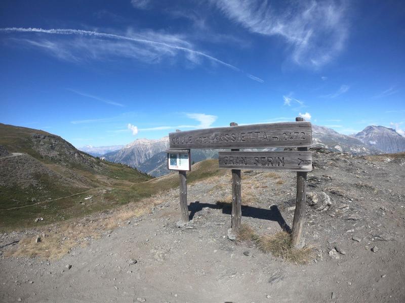
In Susa, Piedmont, treat yourself to a well-earned gelato at Zucchero Di Canna—you’ll need the energy for the legendary Colle delle Finestre. Compared to this, Mont Ventoux feels like a warm-up: 18 km at 9.3%, half of it on rough gravel! Then comes the former military road known as the Strada dell’Assietta—35 km of gravel with a series of spectacular 2,000-meter passes.
At Col Basset, take the track on the right—but check your brakes! The steep descent to Oulx demands full attention.
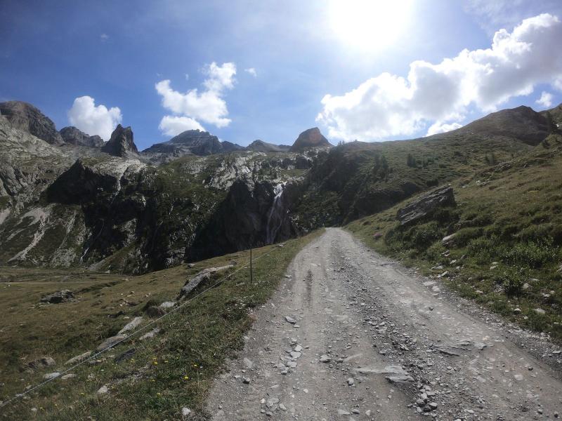
From Bardonecchia, begin the ascent to the Scarfiotti refuge. The first part is paved until Rocha, then 13 km of jaw-dropping gravel scenery. A pause at the refuge terrace is a must—take in the waterfall before descending through Rochemolles back to Bardonecchia. Re-enter France via the Col de l’Échelle and descend into the lovely Clarée Valley.
At Mizoën, head up to the Emparis Plateau—a smooth gravel road through wild, breathtaking landscapes. Take a short break in the mountain village of Besse, then tackle the remote and rugged Col de Sarenne. Continue over the mule path called Cluy to reach Bourg d’Oisans.
Next is the dramatic Col de Solude, with its final gravel kilometer. The short but brutal Paquetout climb awaits. The final mountain challenge includes crossing the Dévoluy and Vercors ranges…
Just 800 km left! A few more climbs in Ardèche and Haute-Loire, then rolling hills through the Bourbonnais. Things calm down along the Loire River and its canal bridges. Enjoy the gentle countryside of Sancerre, the picturesque villages of Sologne, and the peaceful plains of Beauce and Perche. Finally, you’ll return to the Seine Valley—and Pavilly, the finish line.
Services provided:
At the start, you’ll be welcomed at the headquarters of the Amicale Cyclo Pavillaise. A long-term parking area with 80 spaces will be available.
A generous breakfast will be offered in a warm and friendly atmosphere.
Some advice:
- A small gear ratio is highly recommended to tackle steep gradients with ease.
- Tyres: Fast-rolling gravel tyres suited for dry, rocky terrain. A 32 mm section offers a good balance between asphalt efficiency and comfort on rough tracks.
Recommended gear:
- Gravel bike or touring bike with disc brakes
- Long gloves and warm clothing for high mountain sections
How to get there:
- By train: Paris–Rouen line, then Rouen–Pavilly
- By car: From Rouen, take the free A150, then exit towards Barentin
Testimonial from Patrick, who scouted the route during the summer of 2020
First of all, the route begins in Normandy, more precisely in the Seine River Meanders Regional Park. You’ll face some challenging climbs before reaching the charming Eure Valley. Then comes the upper Chevreuse Valley with its magnificent Rambouillet Forest, followed by the Essonne Valley, which will reveal its hidden gems.
At Gien, the Loire by bike and its Canal Bridge await you. The hills of the Nivernais and Morvan regions will warm up your legs before tackling the lower and upper Jura mountains.
Things get serious in the Ain region with the famous, steep Grand Colombier!
You could say the high mountains truly begin at the “Little Venice of the Alps” — a perfect place to take a break by Lake Annecy before attacking the 800 most difficult kilometers of the route. The mountain passes will follow one another relentlessly, each higher than the last, reaching the highest point at 2,764 meters on the French side.
From the Variselle Fort, enjoy the view over Lake Mont-Cenis before descending on the Italian side. In Susa, Piedmont, treat yourself to a gelato at Zucchero Di Canna—you’ll need it to climb the Finestre Pass! Mont Ventoux seems easy compared to what’s ahead: 18 km at 9.3%, half of it on rocky gravel!
Next comes the old military track called the Strada dell’Assietta—35 km of gravel with a string of passes over 2,000 meters.
At Col Basset, take the track to the right, but check your brakes carefully! The long and steep descent to Oulx leaves no room for mistakes.
Bardonecchia is the starting point for the Sommeiller Pass: paved until Rochemolles, then 20 km of track with breathtaking scenery. The last kilometers are rough—3,009 m altitude—the highest point of the Hannibal Rider.
You re-enter France via the Échelle Pass to reach the charming Clarée Valley. At Mizoën, head to the Emparis Plateau, a fast track through wild, magnificent landscapes. A short break is recommended in Besse, a restored mountain village.
The Sarenne Pass is the final climb. You’ll cross the mule path called “Cluy” to reach Bourg d’Oisans.
The impressive slope of Solude Pass includes the last kilometer on gravel. The Paquetout climb is short but brutal!
To finish the chain of passes, you’ll have crossed the Dévoluy and Vercors ranges.
Only 800 km left, with a few more passes to meet in Ardèche and Haute-Loire…